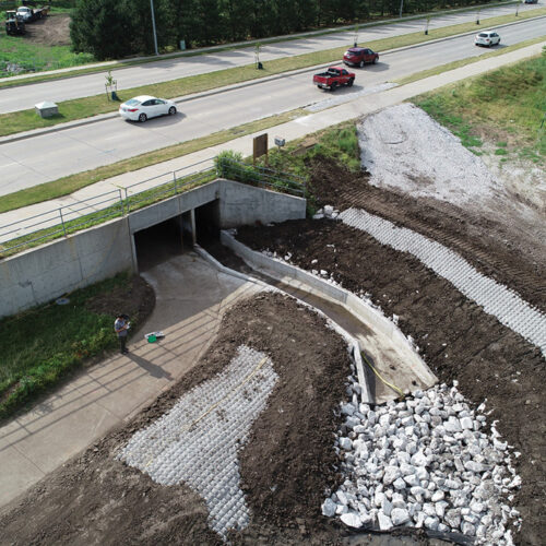
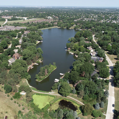
TFG’s experts perform hydrologic and hydraulic analyses necessary for water resources projects with extensive experience in the hydrologic evaluation of watersheds.
This analysis builds the foundation for lake, wetland and stream rehabilitation design projects and guides development of various design interventions.
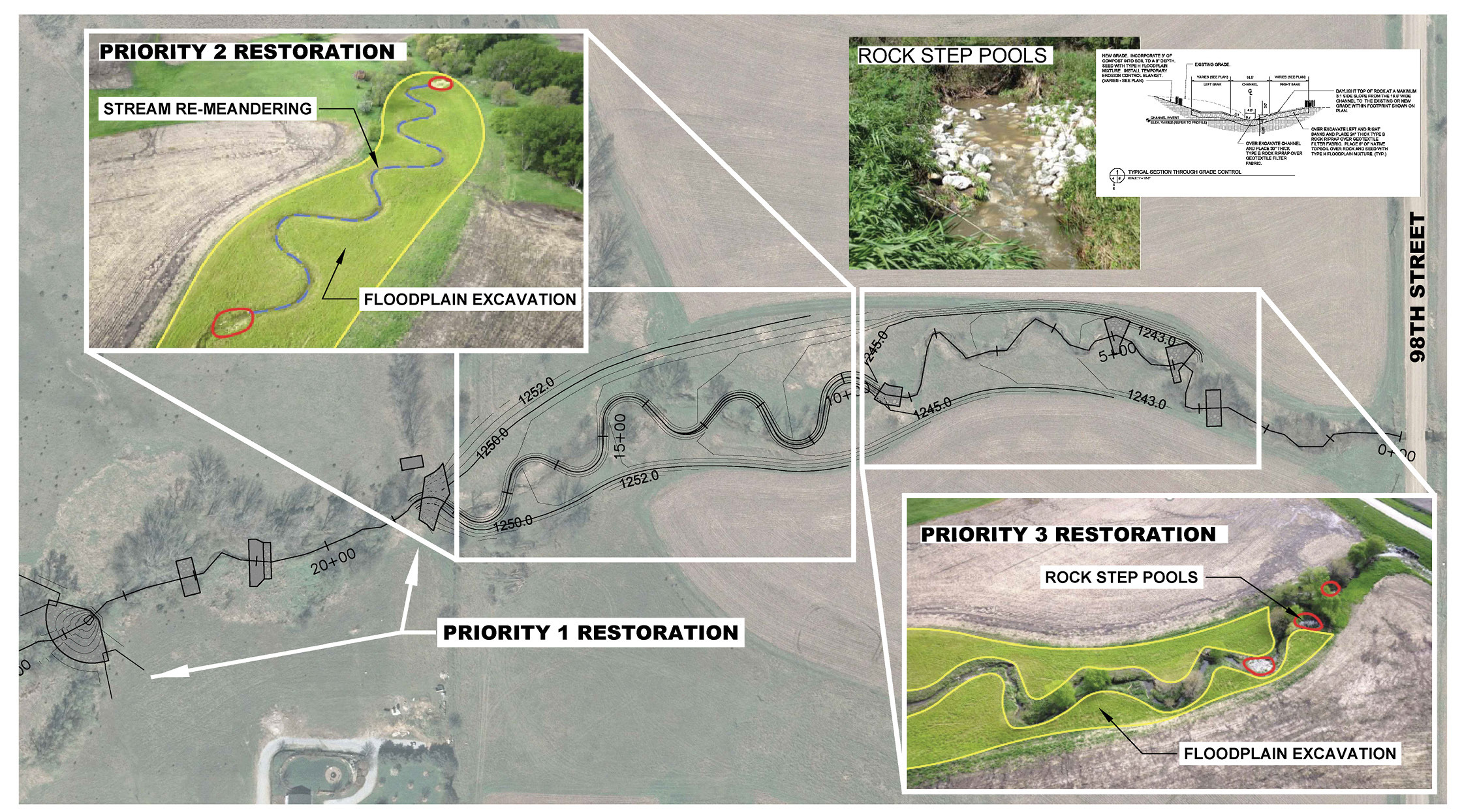
Watershed evaluation service expertise includes:
- Rapid Geomorphic Assessments for stream condition evaluation
- Sediment and soil sampling for sediment transport and bank stability analysis
- Surface water and groundwater sampling
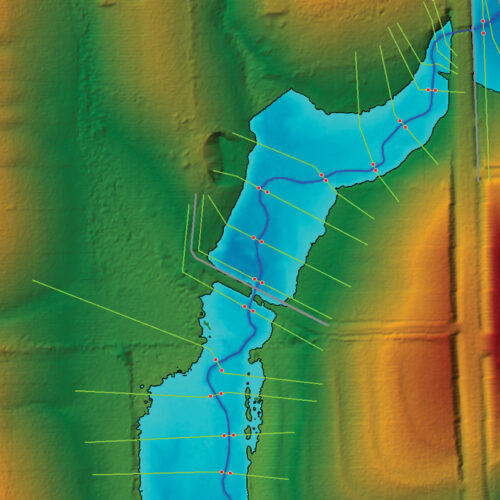
- Multi-spectral drone imagery and LiDAR
- Statistical stream gage and flow exceedance analysis
- State-of-the-art CivilGeo and HydroCAD software capabilities for GIS/CAD generated HEC-HMS, HEC-RAS, and 2D HEC-RAS models
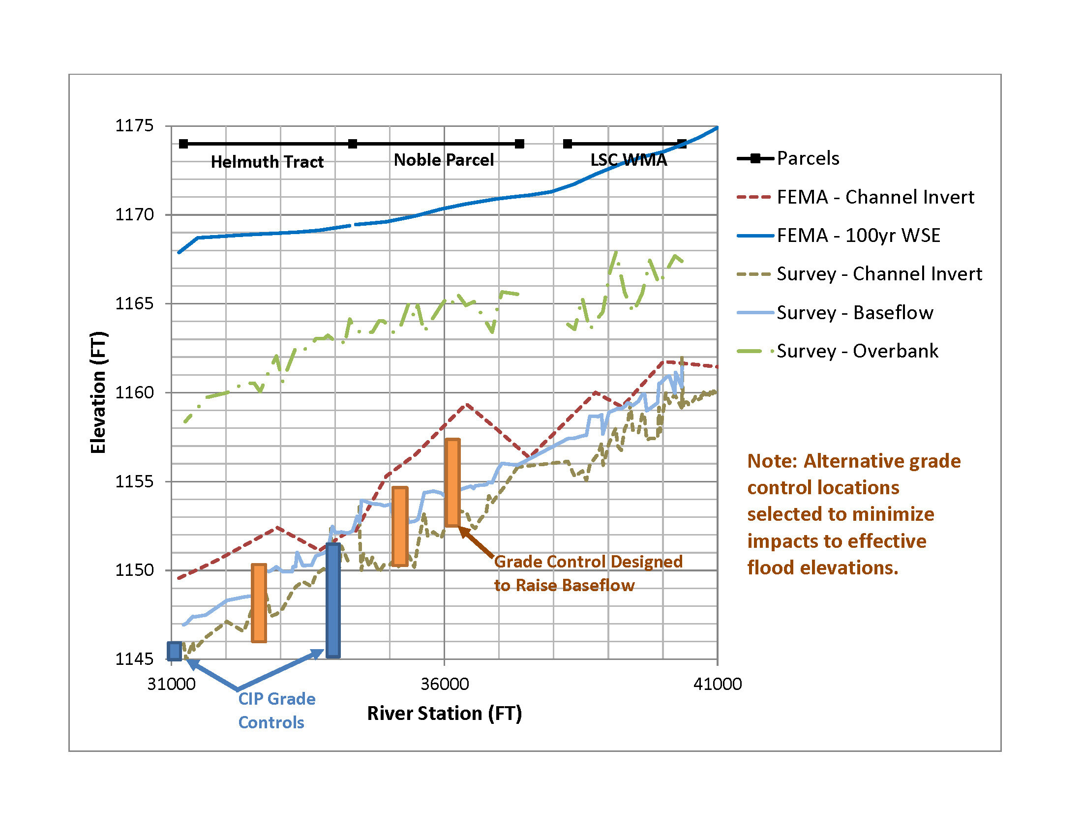
- Stable channel design assessments for shear stress and scour analysis
- Meander pattern and geomorphic assessments for evaluating channel evolution, thalweg hydraulics and pool spacing considerations
- Watershed sediment yield modeling with SWAT (Soil Water Assessment Tool)
Furthermore, nearly all of TFG’s water resources projects are located topographically in floodplains. At the local level, TFG has complied with City of Lincoln Flood Design criteria including:
- Compensatory storage requirements
- No net rise requirements
- Minimum flood corridors
- Mitigation of floodplain for change in zone from agricultural-stream corridor to residential
- Creation of conservation easements
At the federal level, TFG has completed FEMA letter of map revisions and amendments for fill in effective 100-year floodplain.