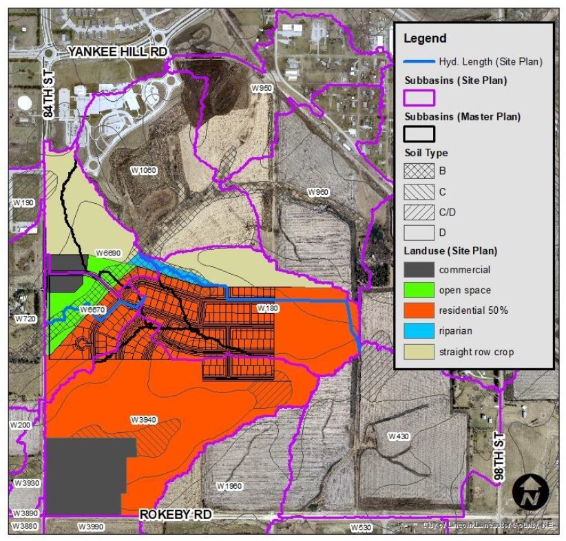
The City of Lincoln and Lower Platte South NRD collaborated with a group of landowners in the Upper Wagon Train Watershed to ensure compliance with Lincoln’s flood regulations for new growth areas. The landowners formed the Rokeby Coalition and contracted TFG to prepare a Master Plan for development in the watershed. TFG compiled previous watershed studies, City of Lincoln GIS data, and hydraulic structure elevation data provided by the client.
Hydrologic and hydraulic analyses were conducted using the U.S. Army Corps of Engineers HEC-geoHMS and HEC-geoRAS modeling software to evaluate flood frequency flows in the watershed. Existing watershed conditions were considered to determine baseline peak flow rates and delineate the 1% and 0.2% annual chance flood hazard areas. Future watershed conditions were considered for planning purposes related to flood regulation compliance, post construction storm water management, and Clean Water Act Section 404 permitting guidance.
This effort included design of shared detention basins among Coalition members to meet compensatory storage criteria, and culvert sizing for new and existing roads to meeting no-net-rise criteria. Stable channel design recommendations were also provided to accommodate stream geomorphology.
Project Photos