Schilling Wildlife Management Area Backwater Habitat Project
Project Client: Nebraska Game and Parks
Project Location: Near Plattsmouth, Nebraska
Project Categories: Wetlands
The Flatwater Group was contracted by the NGPC for design and construction oversight services of a backwater habitat channel at the 1,500-acre Schilling WMA. The objective of the Schilling WMA Backwater Habitat project is to create a riverine backwater habitat area to offset the anticipated adverse impacts of the Omaha area Metropolitan Utilities District (MUD) Platte West Wellfield project. Use of the Platte River by the federally and state-listed pallid sturgeon is well documented and the opinion of the U.S. Fish & Wildlife Service (FWS) is that any further, unmitigated depletion of flow in the Platte River is likely to jeopardize the continued existence of the pallid sturgeon.
Relative to the current riparian community along the Missouri River, the new backwater habitat area is expected to have high biological productivity. Many fish species are expected to colonize and benefit from this new habitat. Of particular importance to the pallid sturgeon will be bottom dwelling species such as common carp, buffalo, carp suckers and suckers. Young of the year of these species will inevitably disperse out of the backwater into the Missouri River. Although pallid sturgeon are not expected to frequently venture into the backwater, they will benefit from the area because of the additional prey the new backwater will provide.
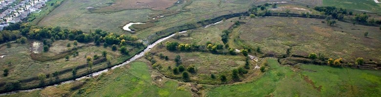
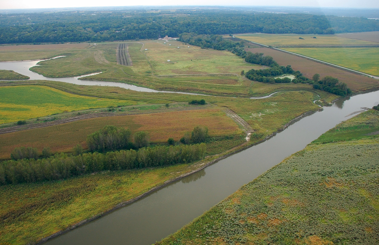
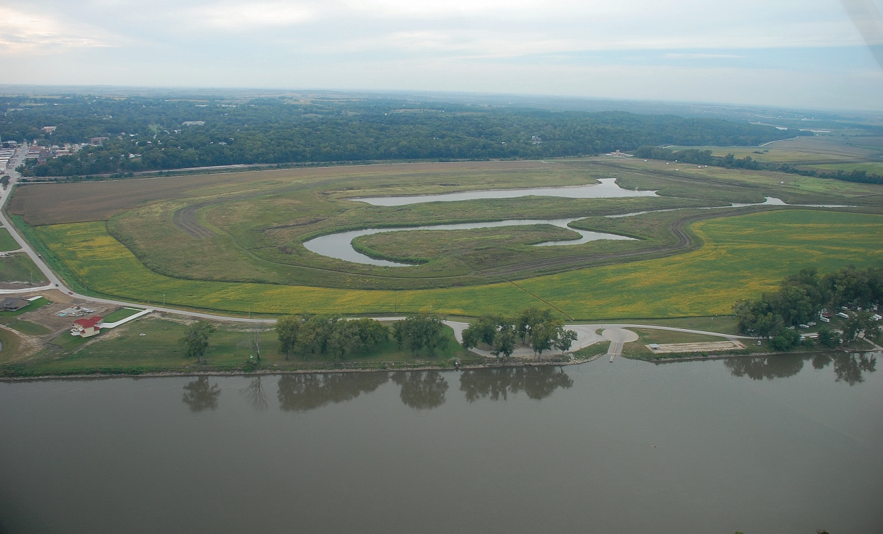
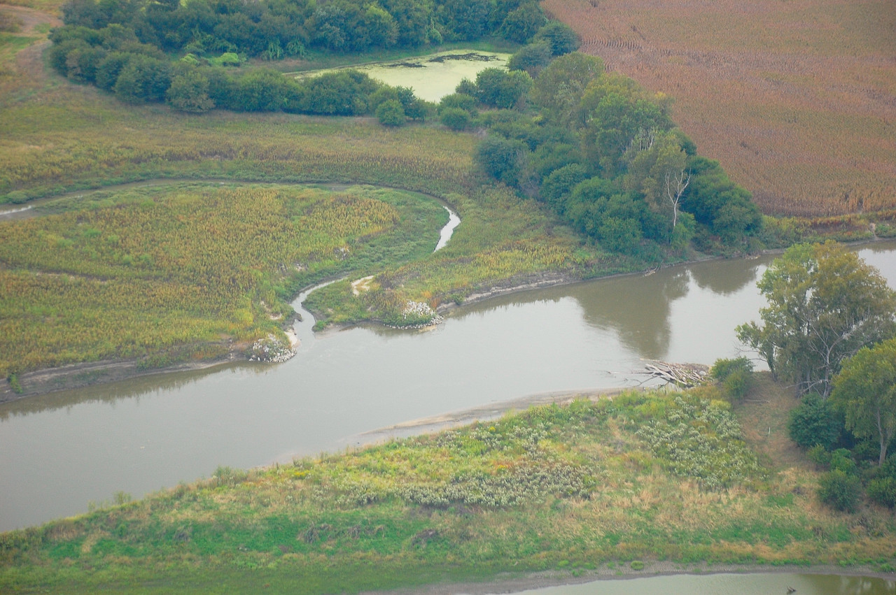
The Schilling WMA backwater habitat project included the construction of an approximately 9,300-foot long, 150-foot wide and 18-foot deep backwater channel. A total of 522,000 cubic yards of earth material was removed for the construction of the backwater channel and it is connected to the completed U.S. Army Corps of Engineers (USACE) Plattsmouth Chute Restoration Project channel. An entry basin to the backwater channel with a rock weir and series of sediment traps was designed at the connection to the USACE chute. The alignment of the backwater channel and the USACE chute were placed to restore a portion of the shallow water habitat of the Missouri River that is evident from surveys of the area in the 1890’s to 1940’s timeframe. The USACE chute’s flows would fluctuate with the Missouri River flow such that the backwater channels will be disconnected for a portion of the year.
The various components of the backwater habitat project include a variety of depths and bank slope regimes to provide ecosystem diversity for aquatic vegetation. A few portions of the excavated channel will provide deeper regions for fish and other aquatic animals. The excavated material from the channel will be placed in spoil piles adjacent to the backwater channel. These spoil piles will provide additional wildlife habitat. Spoil material will also be used to construct a berm/dike that will enclose the backwater channel and protect the City of Plattsmouth’s well field from high water events. The footprint for the spoil piles (built to the base-flood elevation of the floodplain) and protective berm/dike will have a surface area footprint of approximately 65 acres with an average height of 5 feet tall. Construction of the backwater channel was completed in December 2006.
Project Photos

Lincoln Office
8200 Cody Dr, Ste A
Lincoln, NE 68512-9550
Phone: 402.435.5441
Fax: 402.435.7108
.(JavaScript must be enabled to view this email address)
Imperial Office
P.O. Box 1492
Imperial, NE 69033
Phone: 308.882.1840
Contact: Chance Thayer, P.E.
.(JavaScript must be enabled to view this email address)
Designed by Red Bicycle, Inc.